The fifth edition of the Northern Forest Canoe Trail Through-Paddler’s Companion is now available for purchase.
Written by thru-paddler Katina Daanen, the book is the only comprehensive resource for paddlers looking to complete the entire 740-mile trail from Old Forge, N.Y., to Fort Kent, Maine, in one trip.
Designed to be used as a companion to the official Northern Forest Canoe Trail guide book, Daanen’s book provides tactical advice about specific water bodies, including upstream paddling directions, portage descriptions and distances, and mileage markers, while offering suggestions for ordinary, yet sometimes elusive concerns, such as where one might spend the night.
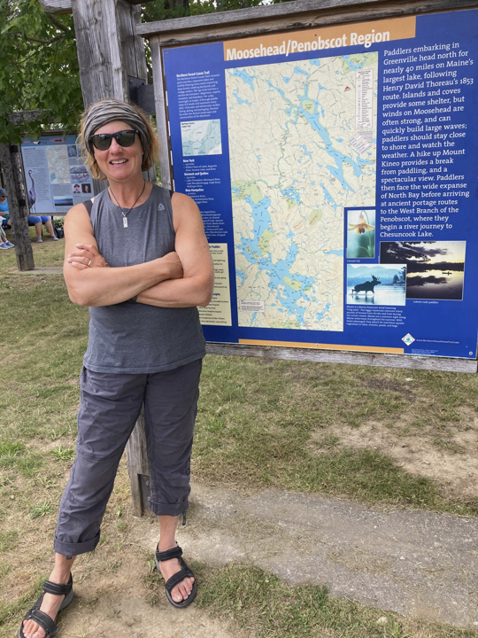
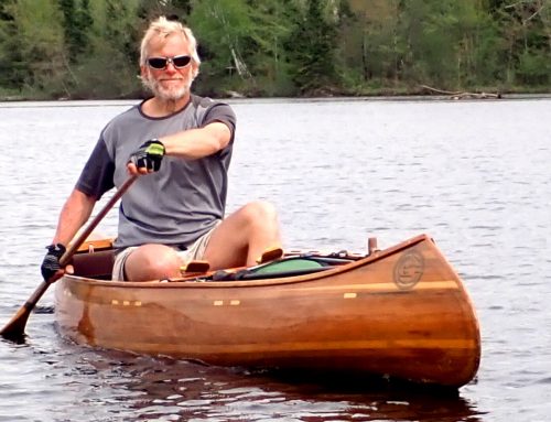
Thru-Paddler and author Katina Daanen
In addition to listing new campsites and updating the services section, the revised fifth edition now includes an appendix outlining an Integrated Thru-Paddler “downstream” itinerary.
Daanen thru-paddled the trail in 2011 and 2021. She produced the first edition of the book in 2014 and the most recent to this one in 2022.
She put together the book with input from other thru-paddlers and the Northern Forest Canoe Trail staff.
The book can be purchased in the NFCT store.
Below is a question-and-answer session with Daanen about the new resource.
Why did you write the Through-Paddler’s Companion originally?
All of the maps and the official guidebook describe the Trail from a downstream direction. It was tedious and sometimes confusing to be reading some of the maps backwards, notably all of Maps 4 and 5. Reading previous thru-paddler blogs helped me learn more about navigating the upstream miles encountered as a west-to-east thru-paddler. However, most blogs were, understandably, written like diaries, and they often lacked details. Or, daily entries were written inconsistently. For example, I didn’t always understand why a particular day might be bad. Was the reported consternation caused by fighting a strong upstream current or because the water was high due to rain? How many miles were being paddled each day? Why the need to stealth camp at a particular place? During my first 2011 trip, I made a point to consistently document each day as a means of “paying it forward” as a resource for future thru-paddlers.
I initially pitched the guidebook idea to several publishers, but the current number of thru-paddlers isn’t big, and sales numbers are small. I am a graphic artist, and I knew I could design and produce a book myself, so I pursued the self-publishing route. It isn’t ideal for mass distribution, but the ability to easily edit my own files has worked well for frequent revisions. The first edition was published in April 2014 and has been regularly updated ever since.
The Northern Forest Canoe Trail Planning and Paddling Log is another book I independently published in 2018. The thinner volume is aimed at families and section paddlers. The book summarizes the Trail and contains journaling pages as a way of documenting ongoing NFCT adventures. It is also being updated this year.
Why did you update it this year and what is new?
The NFCT has continued to improve infrastructure over the years, such as adding campsites, like the one established at Marble Mill Park in Swanton, Vermont, in 2025. In other cases, sections of the Trail have experienced disruptions and reroutes. For a long time, river remediation work meant that parts of the lower Saranac River passing through Plattsburgh were closed to paddling below Catherine Street. The updated book now includes the most current information available to date.
The most significant change that distinguishes this edition is a six-page summary of a Downstream Integrated Thru-Paddle Plan. Mack Truax has perfected this itinerary over several expeditions and has optimized paddling most of the upstream sections in a downstream direction. He has generously shared his tips with prospective thru-paddlers and the NFCT, and we both share a wish to see paddlers having their best trip possible.
Why would someone want to paddle the trail in a way that qualifies them for the Downstream Integrated Thru-Paddling category?
Interestingly, I inadvertently achieved a similar itinerary during my own first trip. Six different people joined me that year, using my car and other methods to meet up at points along the Trail as I progressed East with another person in the bow. Due to a combination of where two of my paddlers met me and the fact I didn’t want to completely kill those friendships, with the help of shuttles, I paddled the Clyde and Androscoggin Rivers downstream. Having now paddled these rivers in both directions, I can unequivocally claim that paddling them downstream is a pleasure.
In contrast, the most charitable thing I can say for ascending them is that it is character-building. While that 2011 trip likely remains the most logistically-complicated NFCT thru-paddle trip to date, for some, the notion of experiencing the entire Trail in one expedition with the help of others might make a Downstream Integrated Thru-Paddle trip more appealing—or possible. This plan would be a great option for anyone interested in a thru-paddle, but who views paddling upstream as daunting. Another significant advantage to following this itinerary is that more water miles of the Trail are likely to be paddled instead of portaged. Many self-supported thru-paddlers end up walking past notoriously difficult sections to ascend, including the Missisquoi, Clyde, Upper Ammonoosuc, and the Androscoggin Rivers. Rather, these rivers might be paddled downstream utilizing shuttles. And you aren’t skipping any Trail miles. In fact, you may be spending more time on the mapped water route and less walking on adjacent multi-use trails and roads.

Katina Daanen and Karrie Thomas on Spencer Lake.
What are some valuable resources people could combine with this book when planning to paddle the entire trail?
In my opinion, there is one non-negotiable resource that thru-paddlers should use, and a bunch of optional ones. Call me old school, but no one should be paddling the Trail without the individual NFCT maps. Devices can fail, or more problematically, fall overboard. What I personally like about printed maps is that they contextually place you within a three-dimensional space in a way that a line on a screen does not. You can look at horizons matching topographic elevations with distant peaks, like Mt. Katahdin, that are labeled on the map.
I do, however, appreciate the NFCT FarOut app as a source of information to have on hand while on the Trail. It’s a helpful tool to confirm, for example, that you are following the route to the correct bay across a big lake like Umbagog. Or finding your way through the maze of the Clyde River fen. I also like seeing previous paddlers’ comments about campsites or other real-time advice on the app.
While it seemingly is possible to use FarOut without any additional NFCT resources, including my book, what the app lacks is detailed overviews and planning advice. There is insufficient data, for example, explaining why some river sections are challenging, and it doesn’t include suggestions for circumventing unpredictable situations, such as encountering low water.
By contrast, The Companion offers substantially more portage details and route information specific to thru-paddle trip needs. The Official NFCT Guidebook is a delightful resource for learning about the Trail’s natural and cultural history. It also breaks down the Trail into detailed segments, but like the NFCT maps, everything is presented from a downstream perspective.
Finally, I recommend following the NFCT Paddler’s Facebook group page, as well as reaching out to the growing community of previous thru-paddlers. Follow their stories and watch their videos. For even more inspiration, read books written by NFCT paddlers. Everyone wants to see you succeed on your own trip.
As someone who has thru-paddled the trail twice, why did you do it?
I’m currently about 80% finished with my third thru-trip, the section paddle I began back in 2012! I’ve canoe-camped my entire life, but most trips fell into the long-weekend or weeklong variety. A thru-paddle of the NFCT affords an end-to-end journey. I felt an immense sense of accomplishment after that first 2011 adventure. To say the NFCT changed my life is an understatement. It didn’t satiate an appetite; it kindled a craving. I returned to the Trail in 2021, partly because this trip would be completed solo and ten years later marked a nice anniversary, partly because the Trail was now like a familiar friend, but mostly because I relish the immersive experience a journey on this trail imparts.
About the Northern Forest Canoe Trail
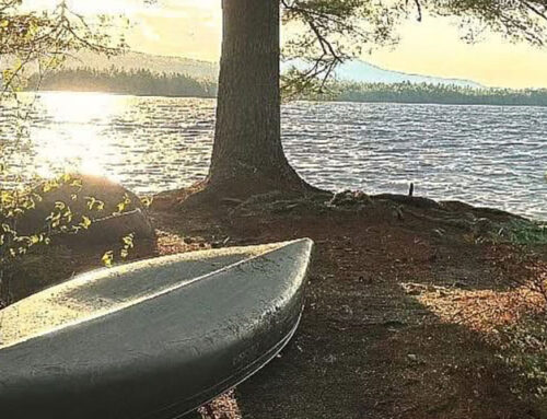
The Northern Forest Canoe Trail is a nonprofit organization based in Waitsfield, Vt., that maintains and promotes the 740-mile water trail that runs from Old Forge, N.Y,, to Fort Kent, Maine, and connects New York, Vermont, Quebec, New Hampshire and Maine. It also hosts a series of events across the Northern Forest, including the 90-Miler that takes place every September in the Adirondacks. The trail showcases the mix of landscapes and communities currently lining the traditional routes used by indigenous peoples, settlers and guides. It is the longest in-land water trail in the nation and consists of 23 rivers and streams, 59 lakes and ponds, 45 communities and 65 portages. To learn more, visit northernforestcanoetrail.org.