Location: Allagash River in the Allagash Wilderness Waterway, Maine
Put-in: Indian Stream
Take-out: Town of Allagash
Maps: NFCT Sections 12 & 13
The Allagash River is an iconic section of the 740-mile Northern Forest Canoe Trail. If you go during the first week of May right after ice out you get your choice of campsites, there are no bugs, no thunderstorms, and no crowds. You also get snow in the woods, mud in the campsites, cold howling headwinds, below freezing nights, and maybe hypothermia inducing rain. I wouldn’t send a neophyte paddler on this trip at this time of year but it’s a wonderful time for more experienced canoeists.
Day 1
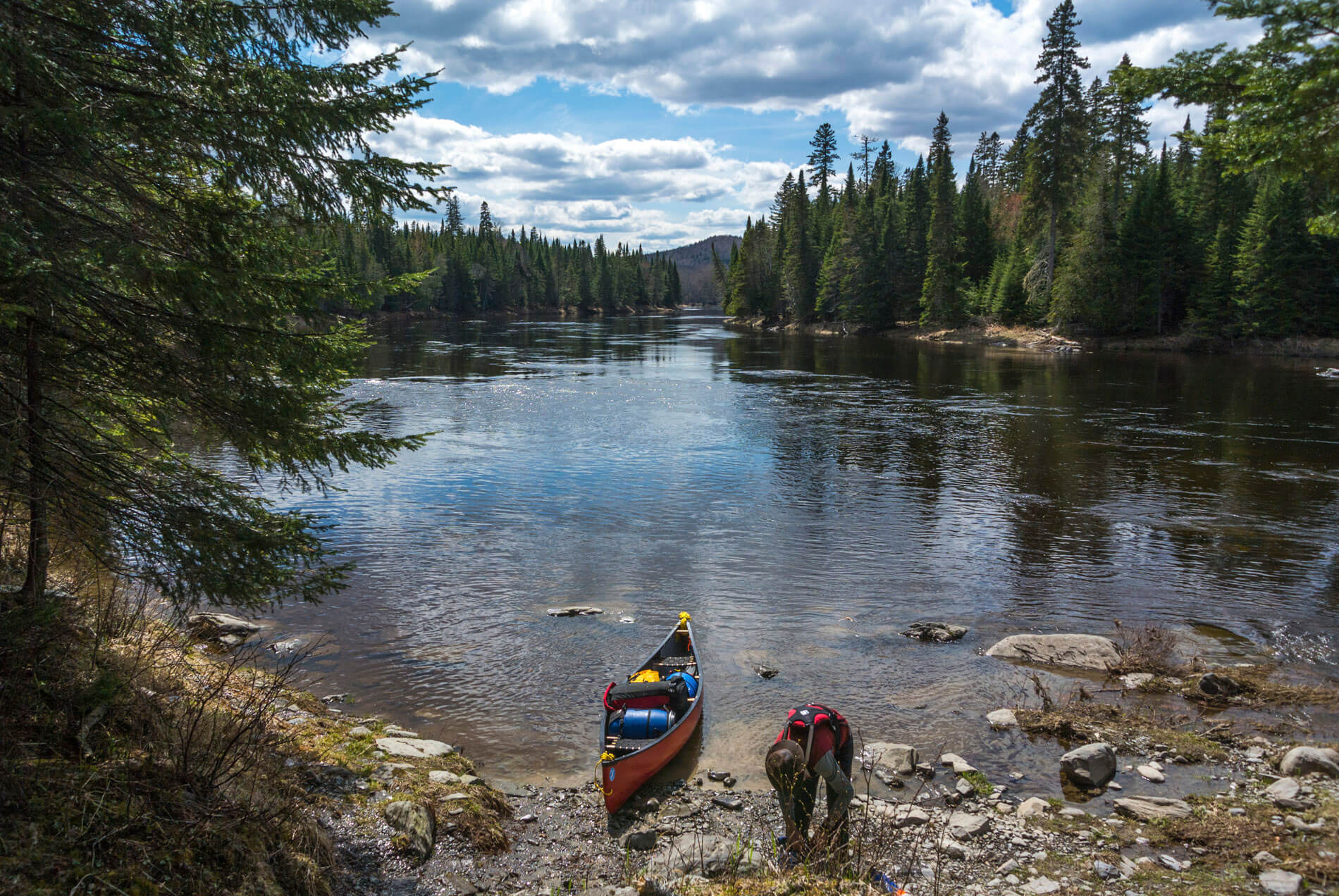
Our group consisted of six people and a dog in three canoes. After shuttling, everyone eventually ended up at the Indian Stream put-in, ate lunch and headed down the narrow but lively brook to Eagle Lake. An added bonus this time of year is plenty of water in the streams.

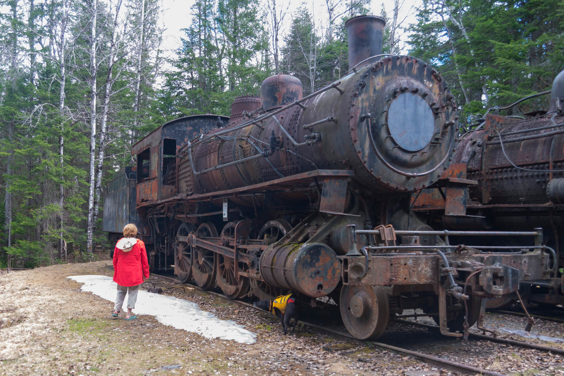
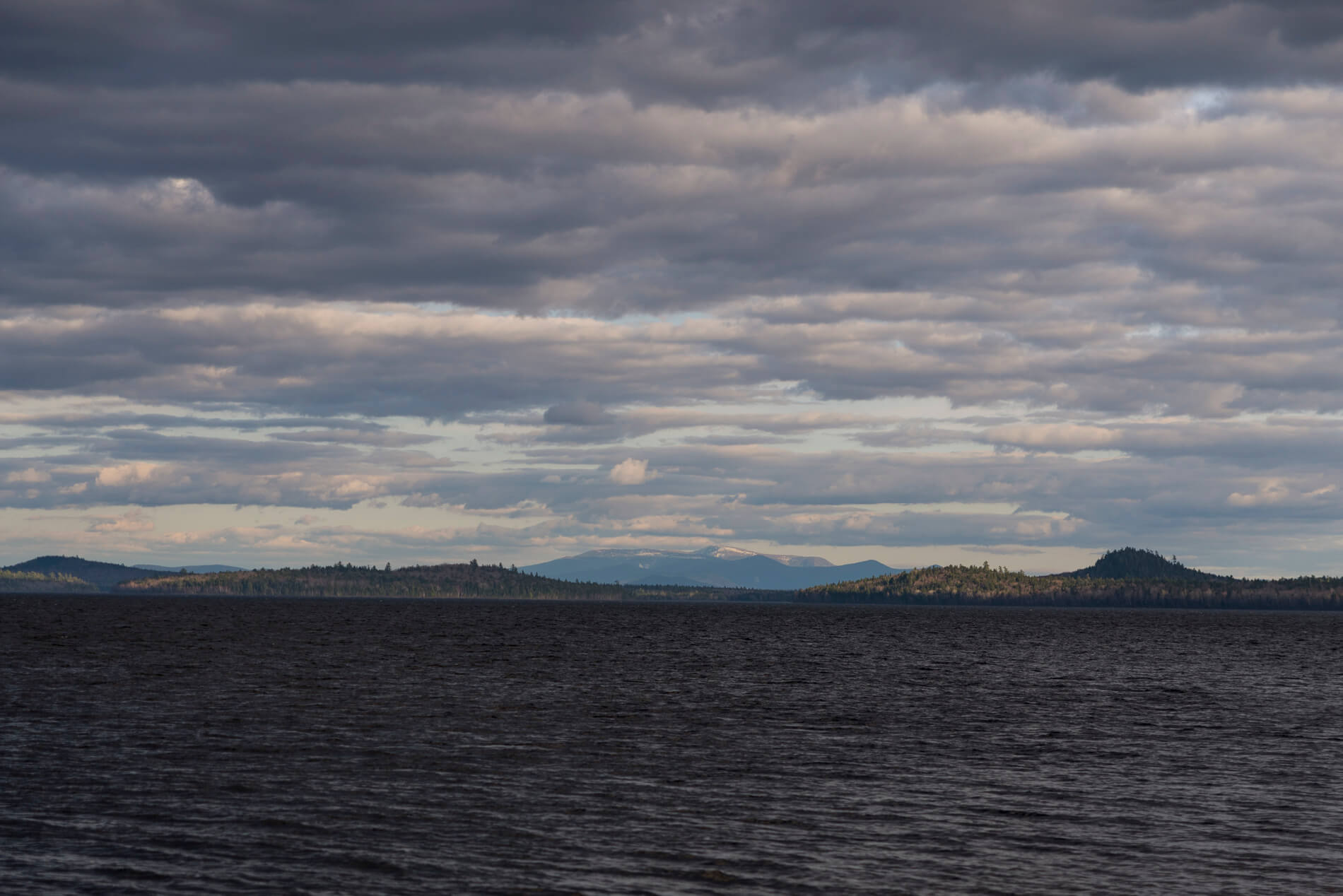
The Allagash is a fantastic experience. The only signs of humans are some inconspicuous ranger cabins and a few bridges. The exceptions to this are the aging historical remnants of the logging industry scattered along the river. We paddled to the end of the Tramway Carry and poked around the rusting skeletons of two long abandoned steam locomotives. After some pictures we continued into a moderate headwind to Farm Island campsite with a wonderful view of snowcapped Mount Katahdin off to the south.
![]()
![]()
Day 2
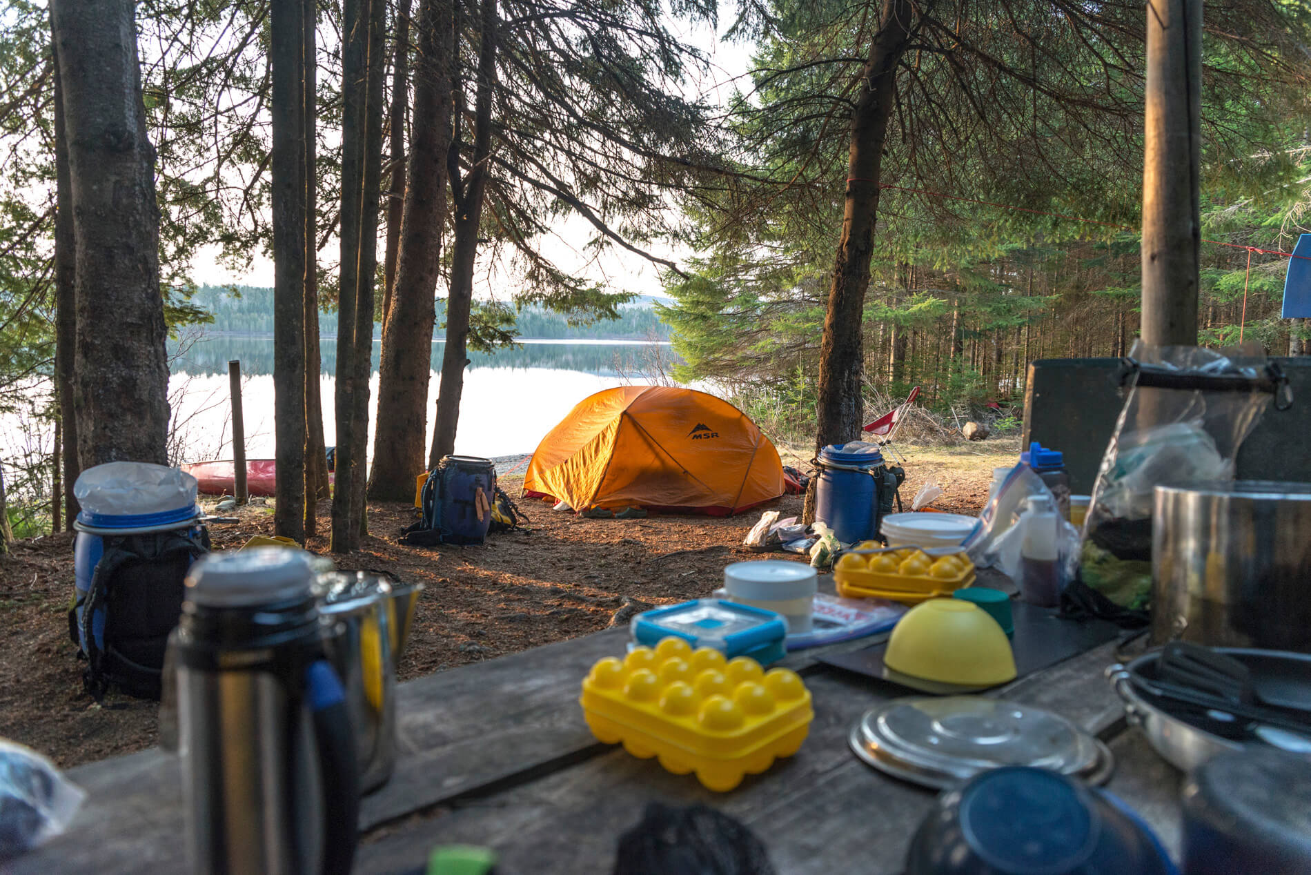
I woke on the second day at about 4:30 am to watch a beautiful sunrise. I noticed frost on my PFD. The water was dead calm until after breakfast and the view was fantastic. We enjoyed Eggs Benedict for breakfast and the hot coffee was perfect. It’s a pleasure to camp with experienced trippers and to see how smoothly meals are prepared, camp is broken, and canoes are loaded and readied for travel.
Pamola is the Abenaki spirit who guards Mount Katahdin and causes the weather. For some reason he was not pleased with us today. We set off into a firm cold breeze, paddling behind islands and hugging the shore. We chose to wear dry suits in case of a swamping. The water was 41 degrees and the air temperature wasn’t much higher.
After a few miles we surfed onto the beach at the Eagle Lake ranger station and took a break protected from the wind and warmed by the sun. The most direct line would have been a dangerous one to follow so we continued to follow the shore in order to avoid the strengthening north wind. There were times when we were unable to go anywhere but straight into the gale. We watched the wind ripple the water to prepare for the gusts approaching us. Across Russel Cove into Round Pond, under John’s Bridge, and into Churchill Lake, always fighting to keep moving and not to get blown backwards or sideways.
It was a hard fought 9-mile day but we were rewarded with a stay at Scofield Point campsite, perhaps the nicest site on the Allagash River. Of course the wind tapered to calm as we arrived. We chose sites under large white pines and a soft floor of golden brown fallen needles.
Day 3
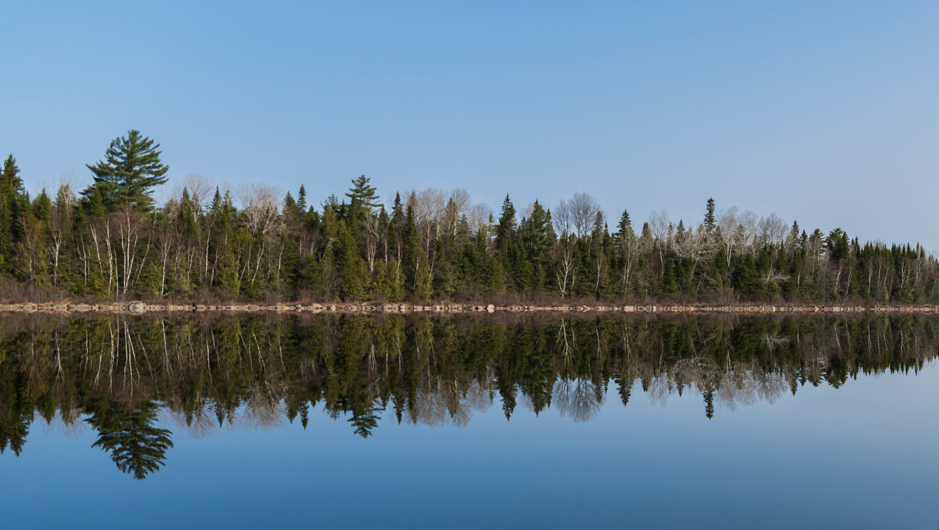
The next day was the kind of day you dream about as a paddler. The morning started with absolute calm conditions. Not only does the water reflect light but it reflects sound as well. We practiced identifying birds by call from the forested shoreline. There were several kinds of thrushes as well as the expected warblers and other songbirds and woodpeckers.
Soon we arrived at Churchill Dam and were met by rangers who shuttled our gear around Chase Rapids. I think they told us we were the third or fourth party of the year to pass through the area. Chase Rapids is not particularly difficult but it does keep your attention. Fairly continuous and fun white water weaves and drops through the forest for about 4 miles down the Allagash River to where you can retrieve the shuttled gear at the former Bissonnette Bridge.
The rapids lessened in difficulty and eventually the river flattened out and entered Umsaskis Lake where we stopped for lunch. The afternoon winds were gentle but steady and each canoe found its rhythm. Alternating conversation and silence accompanied us through the thoroughfare into Long Lake. A guided group with several boats preceded us. They followed the eastern shore to one campsite and we took the western shore to Sam’s campsite about halfway up the lake.
I’ve spent a lot of nights camping on lakes and heard a lot of loon calls, sometimes even wishing they would be quiet so I could sleep. The loons on Long Lake were plentiful, loud, enthusiastic, and persistent. I heard loon calls I had never heard before and I think that goes for the other members of the group. It was one of those magical experiences that even seasoned adventurers will remember for a long time.
Day 4
We had another early morning and pleasant paddling to the remains of Long Lake Dam. After negotiating the short carry around the dangerous little rapid, we re-embarked on the trip down river. Easy rapids and enjoyable quickwater almost effortlessly sped us downstream. We passed several motorized canoes heading upstream with guides and clients. I was astonished at the sound of the propellers hitting rocks on the streambed. After a nice lunch we entered beautiful Round Pond, the last pond on the Allagash.
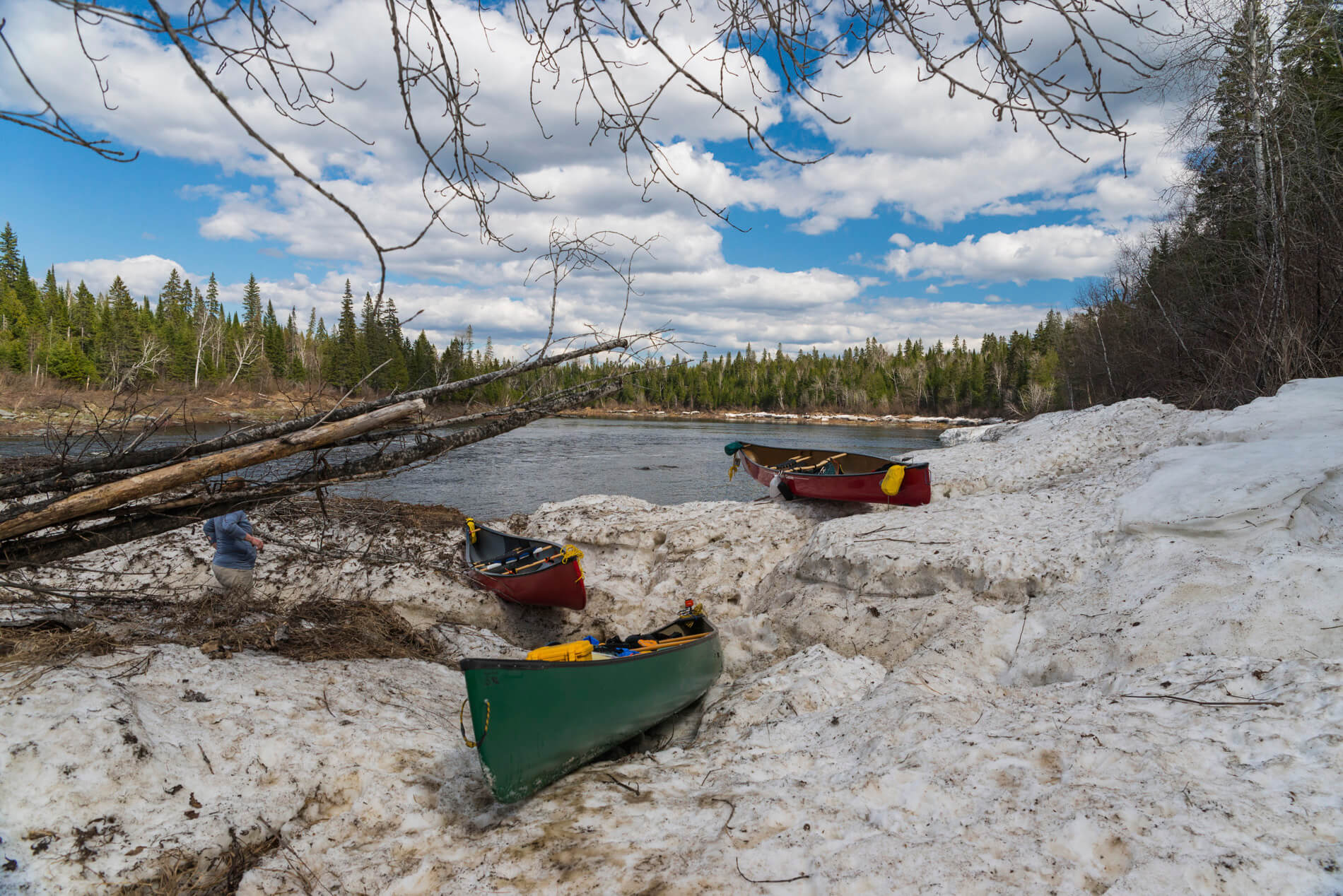
More and more snow was visible in the woods along the shaded side of the river, the last remnants of winter in northern Maine. At one point the river takes a strong turn to the north and enters Musquacook Deadwater. We were met by a friendly ranger and chatted for a few minutes. He was out cleaning sites and catching trout for his dinner (there are some brookies in the river).
The ranger recommended Five Finger Brook West campsite which is where we stopped. Because it was clouding over, we set up camp with the thought that it might rain. It did but we were prepared with a large tarp over the picnic table and it cleared by morning.
Day 5
By the time we set off it was mostly sunny and the temperature was enjoyable. The Allagash River widens out as you progress north and offers more views of the surrounding hills. We stopped to look at the Lombard Haulers, some ancient old logging tractors in the woods and then preceded downstream to the last ranger station at Michaud Farm. We had lunch in the warm sun at the ranger’s picnic table as he told us about the 50th anniversary of the Allagash Wilderness Waterway. We headed off down the braided river towards Allagash Falls and the only real carry on the trip, only 1/4-mile long.
We landed at the take-out and brought all of our stuff up the steep bank and began carrying the boats and gear around the falls. Everything went well until the last 50 yards where we encountered a huge snow drift. Two people tried to carry over it but the snow was rotten and they sunk in up to their waists. The snow ended in a 6-foot near vertical wall. We looked for a way around but nothing seemed very promising. Eventually it was decided to load up the canoes and slide them over the snow, and then unload them and pass everything down to the bank. While this was time consuming it was also kind of fun and a unique challenge. Another couple of miles of pleasant paddling and we were at our last campsite, Big Brook North.
 Day 5
Day 5
Another very nice campsite for the final night but it couldn’t last forever and the rain began gently as we left camp on the last day. We only had to paddle about 10 miles to the take-out as the rain grew harder and seemingly colder as we went. Once again we quietly went into a steady rhythm of paddling to get it done. The final rapids would have been enjoyable in better weather but they were paddled with workmanlike efficiency into a headwind with rain in our squinted eyes. We were prepared with plenty of warm clothes and dry suits to keep us warm but it was a cold early spring rain in northern Maine.
It was nice to land and get into a warm car, have a well-cooked burger in Fort Kent, and head home.
Chris Gill completed his section-paddle of the Northern Forest Canoe Trail between 2008-2015. He and his wife Patty maintain the Nulhegan River in Vermont from Nulhegan Pond to the Silvio O. Conte National Fish & Wildlife Refuge in Brunswick.