(Editor’s Note: This trip took place on May 20 and 21, 2019)
My alarm sounded at 5:30 am, and I immediately checked the weather forecast. Pouring rain, high winds, lightning and hail in varying measure over the next 48 hours in Rangeley, Maine. Sending a screenshot to my paddling partners currently scattered across Vermont and New Hampshire I texted them, “Looks like a great day for paddling!”
I hustled through the remainder of my morning: coffee, breakfast, pack, kids to school, and drove away from Waitsfield at 8:30 a.m. in an attempt to meet Katina and Russ at Ecopelagicon, an outfitter in Rangeley, Maine, by noon.
We had scheduled this trip down the South Branch of the Dead River at the one moment when we could all get there at the same time. The river runs between Rangeley and Flagstaff lakes in western Maine and is notoriously finicky. We had only a wild hope that there would be water in it, but Mother Nature obliged us for once, and the skies opened up the day and night before. Our problem was there more likely to be too much water.
While we made thorough work of scouting the main hazard on the upper portion of the river, Fansanger Falls, I heard my friend Alan’s voice in my head as we scrambled over rivulets of run-off careening toward the rising river, “The South Dead is a dried up ditch.” Well, not today!
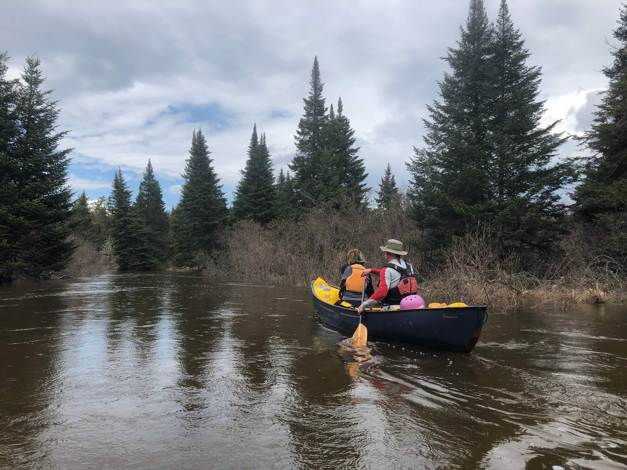
We discovered no wood in the rapids and somewhat tight but clear lines for the tandem Dagger Dimension that Russ and Katina planned to paddle. This “old school” whitewater canoe with bow and stern airbags was fit for the job. Russ said he was pleased with the look of the lines. Katina, a competent paddler up to class II, had enlisted us to help her experience this section of river firsthand. She trusted us. Not having a solo whitewater canoe at my disposal, I brought my whitewater kayak, a Prijon Pure.
We set our shuttle at the Langtown Road bridge and drove back up to put-in at Dallas Camp. The water was about three feet below the Highway 16 bridge when we put on. All suited up with my boat at the bank of the river, I noticed the rivulet of water flowing into the parking lot. Peering at my car I decided at the last minute to pull it closer to the exit and onto higher ground. Better safe than sorry!
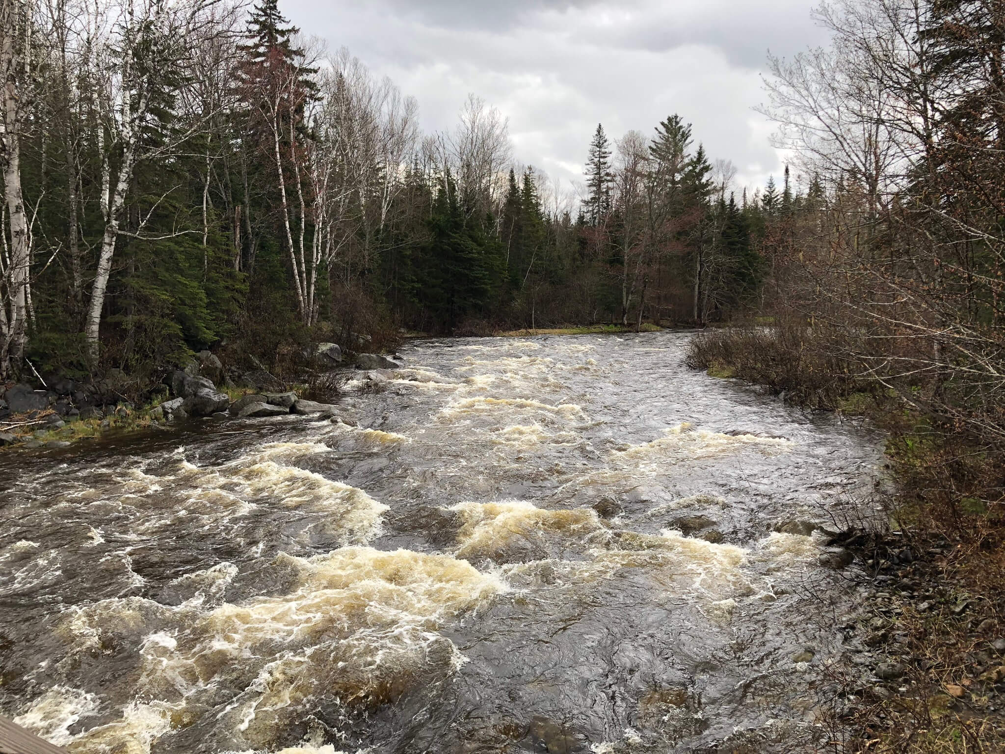
The first 1.5 miles were meandering and fast-moving flatwater. We came upon one tree across the river causing a decent log jam that we had to portage around, but otherwise the warm up was uneventful. Despite the ominous forecast, we had mostly cloudy skies and even a few glimpses of sun as we floated downstream. The rain that fell over the previous two days was evident: hundreds of wild little streams were depositing additional flow into the river along the way.
We passed the first portage take-out above Fansanger Falls and noticed, that at this water level, the eddy would have been incredibly hard to get into in a canoe, especially in a loaded tripper. Fortunately, we were all in the right boats for the water below. From that point until the lower portage take-out where the rapids jump to class III for about .25 miles, we found fun bouncy class II in a bank-full river. I approached the constricted gorge that makes up Fansanger Falls with the lines fresh in my mind. Recognizing my advantage in a whitewater kayak, I probed ahead and did my best to show Russ and Katina the way through.
I hopped in a few eddies to make sure they were still with me. They smoothly maneuvered through the heavy waves and landed in the convenient eddy just above the “falls” itself to empty a little extra water out of their boat. I dropped down the chute to the left of the decidedly large crashing wave pushing against the cliff to the right. I tucked into the eddy and gave them the paddle signal – LEFT!
The next thing I saw was the broad underside of the canoe as they came out of the eddy into a badly timed wave, which caught them over the bow and capsized them. I considered whether I had time to stand and throw a bag to the swimmer or if I would be better off in my boat to chase the canoe. Katina washed down the meat of the rapid and got dunked in the swirling outflow, before she found a slow spot and made her way to the right bank. Russ did his best to keep hold of the canoe, and I was almost there to help him secure it when it broke free of his grip and floated past.
Making sure they were both safe and unhurt, I jumped back in my kayak and chased the canoe down the remaining 50-plus yards of the rapid and caught up to it broached safely on a pile of rocks. The bow and stern float bags stayed firmly in their laces and did their job admirably. The boat was unscathed, and by the time Russ made his way down to me, I had all the water out and it was ready to roll.
While the water was cold and fast, we were “dressed for the swim.” Everyone was unhurt save a few bruises from banging into boulders. The remainder of the river to the Langtown bridge was bouncy class I and II providing a fun for an hour or so, and we got to the car before the day’s final downpour.
I was very glad that I moved my car at the put-in! The river rose to the I-beams on the bridge while we were paddling, and the parking lot was under water.
We had an afternoon start at the top, so we decided to paddle the lower stretch of the river on the following day. Since our objective was to paddle the whitewater, we put in at the Kennebago Road access and took out at the public launch at the Highway 27 bridge in Stratton on Flagstaff Lake. As far as we know, the section between Langtown and Kennebago is flat water with no significant obstacles.
The wind across Flagstaff Lake was howling from the northwest. We nearly abandoned our mission out of fear that we would struggle to make it across the final mile to the take-out. But the water level remained high, which is a thing to take advantage of on the South Branch of the Dead, and ultimately we put on with both enthusiasm and caution as we probed down to the rapids below.
The majority of the river was quiet water and quick water. After about four miles, some fun class II leads in to a longer class II-III, which likely slows down to a few separate rapids at lower flows. As it stood, the lines were easy enough to find in my creek boat, and Russ and Katina made a good job of following me up until we came to a bigger ledge drop that, given the previous day’s tip, didn’t seem worth trying. The swim would have been long and bumpy and a good chance of the boat floating away before we could stop it. Russ, who has extensive lining experience, made quick work of skirting the boat around the hardest segment of the rapid. This was about 100 yards all told. The high water made it wet work, and he was glad of his drysuit since it was up to his knees and even waist at times.
The final drop of any size was a significant rapid passing through an opposing pair of cliffs. Russ noted that we were getting close to this section when we passed an old slide on river left followed shortly by high and narrowing banks. The bottom of the rapid is hidden from view from the top and the crux is right between the cliffs. A clear wide line is available on the left, but a run down the right would send you straight through a large wave pushing against the right wall. It’s not possible to line this section and no portage trail exists. The rapid lands in a pool where it would be easy to pick up the pieces.
Russ and Katina managed this section without incident. We all felt a rush of triumph knowing we had tackled the hardest parts of the river. We paddled on and were rewarded for our perseverance with a remarkable air show towards the end of the day from a series of at least seven bald eagles all flying in a very close air space. One was even – seriously – swimming in the river with its wings raised up taking paddle strokes.
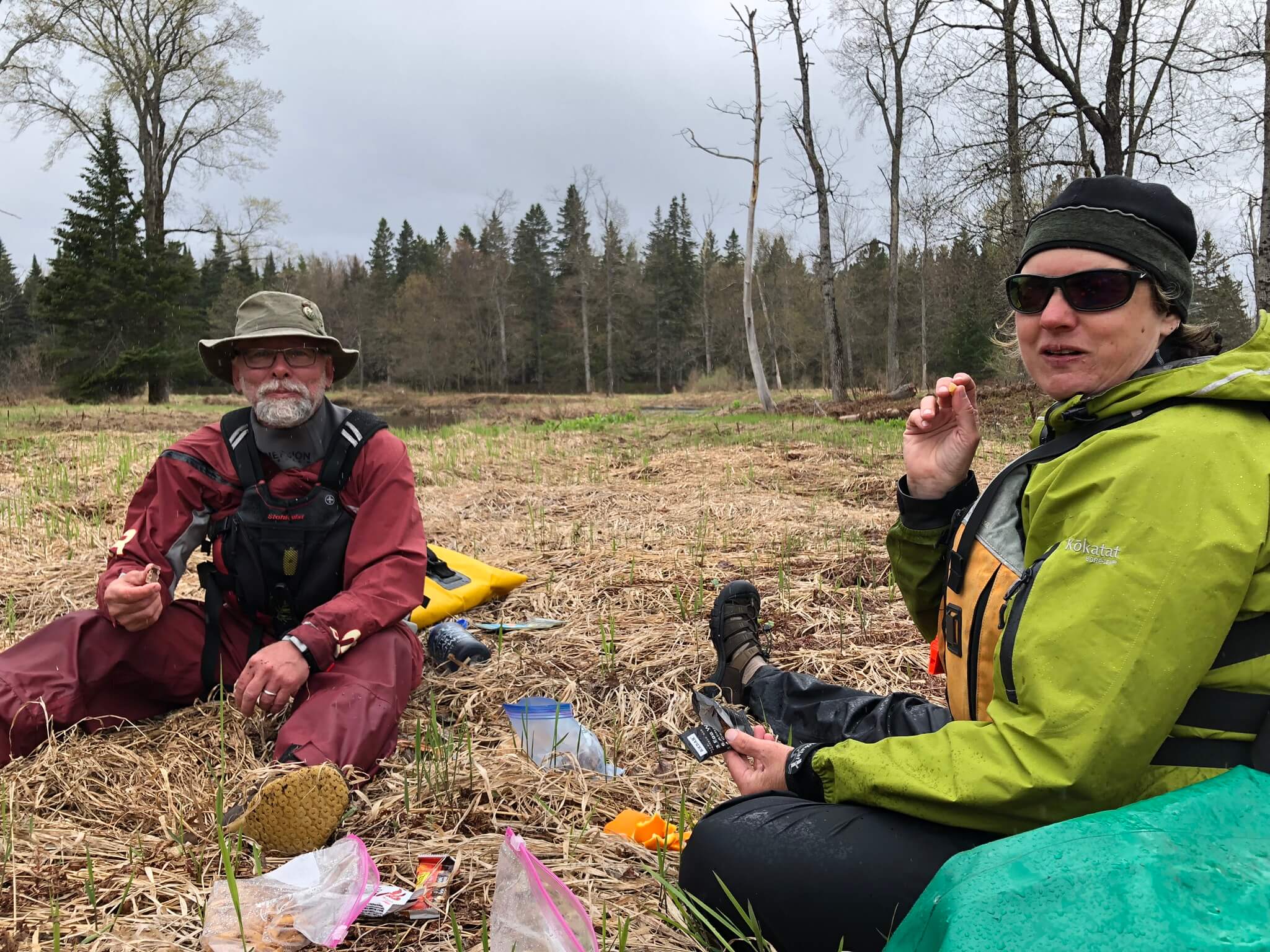
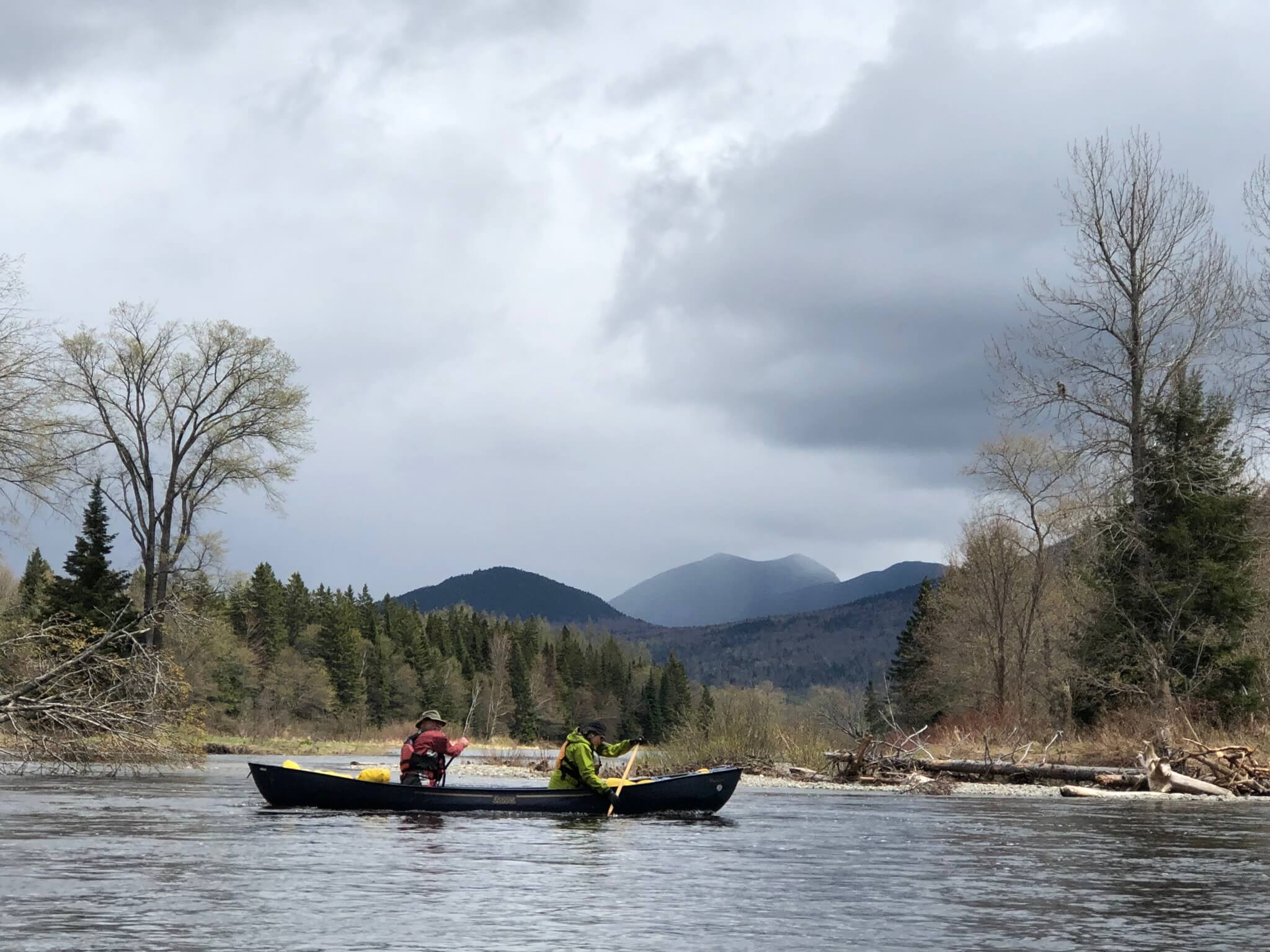
We continued down to the lake enjoying the view that opens up to the Bigelow range. Approaching the backwater from Flagstaff Lake, we had a quick lunch on a small island, which is likely not an island at lower water.
All told, we defeated the weather forecast as well as the odds of having water in the river. Despite the threat of rain, lightning, hail and wind we threaded the needle even finding sun. In the exceptionally wet and cold 2019 spring, I’ve been very glad to be a paddler, and our time on the South Dead was well worth the effort and planning.
_______________________________________
ADVISORY: At the flows we had, I would not recommend this in a loaded boat, and solid class III whitewater skills are required unless you plan to line through the rapids, and one rapid would have been impossible to line. The 2019 NFCT GIS crew, comprised of much less experienced paddlers, ran the section below Fansanger Falls the following week and had a really fun time. The flow makes a huge difference in the type of challenge you will find. It’s hard to imagine a flow where Fansanger would be wise in non-whitewater boat or with a load.
CORRELATED FLOW INFORMATION: Below you will find Russ’ correlated flow information to help in considering any potential trip on the South Branch of the Dead. This is not a guarantee of predicted flow. This is provided for planning purposes. You must scout the river at Fansanger Falls and look at water levels for yourself before deciding to run this section.
The Spencer Stream USGS gauge peaked at between 1600cfs and 1700 cfs while we were on the South Branch of the Dead on May 20 and 21, 2019.
Spencer Stream peaked the morning of the 21st. If I recall correctly, we observed the South Branch at Dalles Camp bridge to have peaked late in the day on the 20th. So IF the two watersheds received comparable rainfall (which we do not know), the conclusion is that the upper South Branch is a slightly smaller, steeper, ‘flashier’ watershed.
Past observations of South Branch water levels, and how they correlate with Spencer Stream gauge readings, provide three ‘data points’. When it was 300 cfs at Spencer Stream, the South Branch was too low for a thru-paddler. When it was 1400 cfs at Spencer Stream, Chuck Horbert’s group of expert solo open boaters found the South Branch to be ‘ideal’ – they paddled everything except Fansanger. And at 1600 – 1700 cfs (at Spencer) we needed to do some lining and appreciated the K-boat scouting in our open ww tandem. –
I’m not sure how I would have felt trying to run the lower South Branch at that level in a loaded Penobscot or Minn II. However, I think at lower water levels (above 300, but below 1400) a thru-paddler could consider trying that section rather than wheeling the road.