For thru-paddlers on the Northern Forest Canoe Trail, side trips, such as this one from Raquette Lake to Blue Mountain Lake, are a luxury few can afford. On the other hand, section paddlers often take their time and are treated to a well-rounded paddling experience. Anyone interested in exploring a little more of what the Adirondack portion of the NFCT has to offer, paddling from Raquette Lake to Blue Mountain Lake via the Marion River is a great option.
South Inlet to the Marion River
I’ve had the privilege of canoeing this route three times, once in each direction and a third time while racing in the Adirondack Canoe Classic, also known as the 90-Miler. What makes this roughly 15-mile route so enjoyable for me is the sense of heightened expectation that comes along with the trip. As you paddle from Raquette Lake into the mouth of the Marion River, 3,760-foot Blue Mountain towers in the distance, waiting for you to arrive at its base. This peak is a well-known icon of the central Adirondacks, visible from all directions as you drive or paddle into the hamlet of Blue Mountain Lake.
It was a sunny July day when I put my Placid Boatwork’s Rapidfire in the water at southern shore of Raquette Lake. This body of water, the fifth largest in the Adirondacks, is known for being choppy, and the waves this morning were no exception. The Rapidfire handles well in rough conditions; however, being an open canoe, it can still take on water in larger swells. Some find this understandably intimating, but I enjoy the challenge of it, a testament to my luck of never having swamped a loaded canoe – at least not yet.
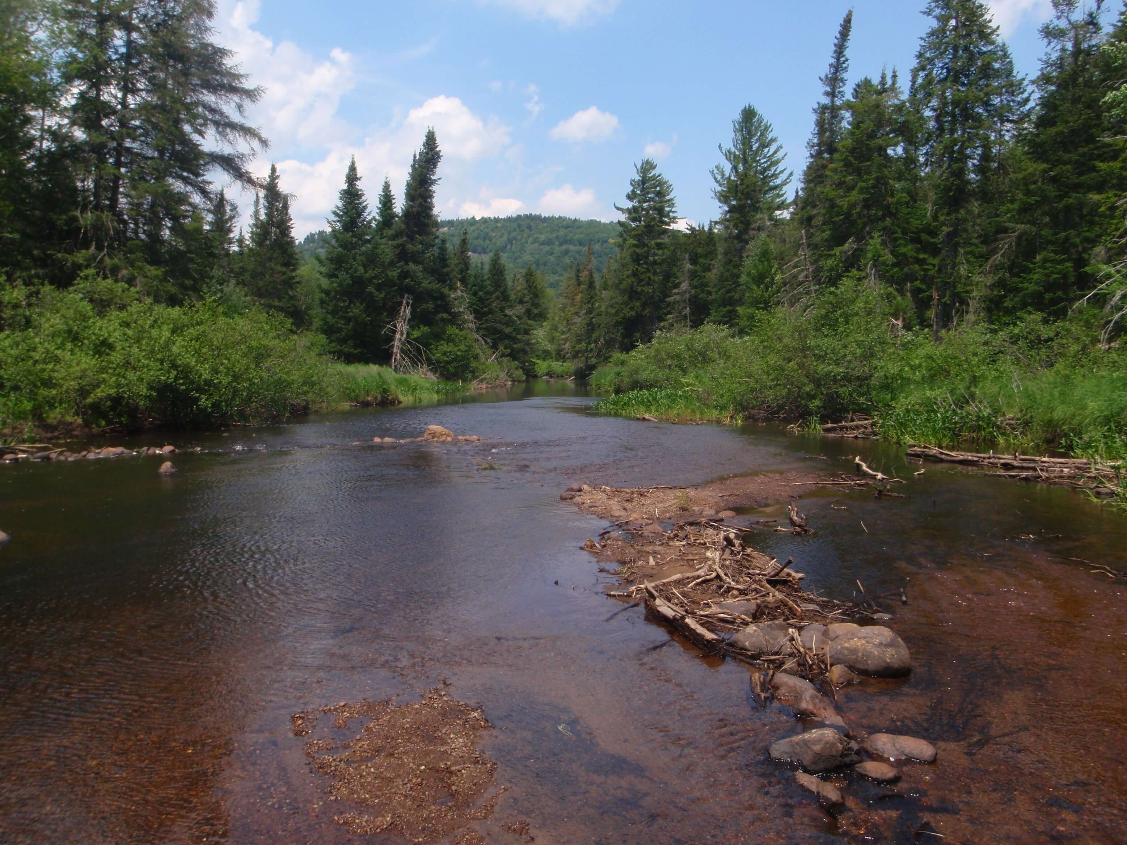
The Marion River
Once through the wind and waves, I entered the mouth of the Marion River, passing a group of chattering boy scouts who were at the rocky campsite on my left. As I paddled upstream into the large wetland that surrounds the river, the familiar “conk-la-ree, conk-la-ree” call of the redwing blackbird greeted my ears. Sometime later I passed the trailhead to Lower Pond, a hike I chose to forgo in exchange for my planned ascent of Castle Rock toward the end of the trip. A few more twists and turns brought me to a section of river with several small islands and a few different channels to choose from. It was here that made a slight navigational error during the 90-Miler several years earlier, and ended up facing the people I had previously passed. My apologies to the racers behind me who made the mistake of following our canoe that fateful afternoon, thus adding a few unwanted minutes to their overall time!
Portage and Eckford Chain
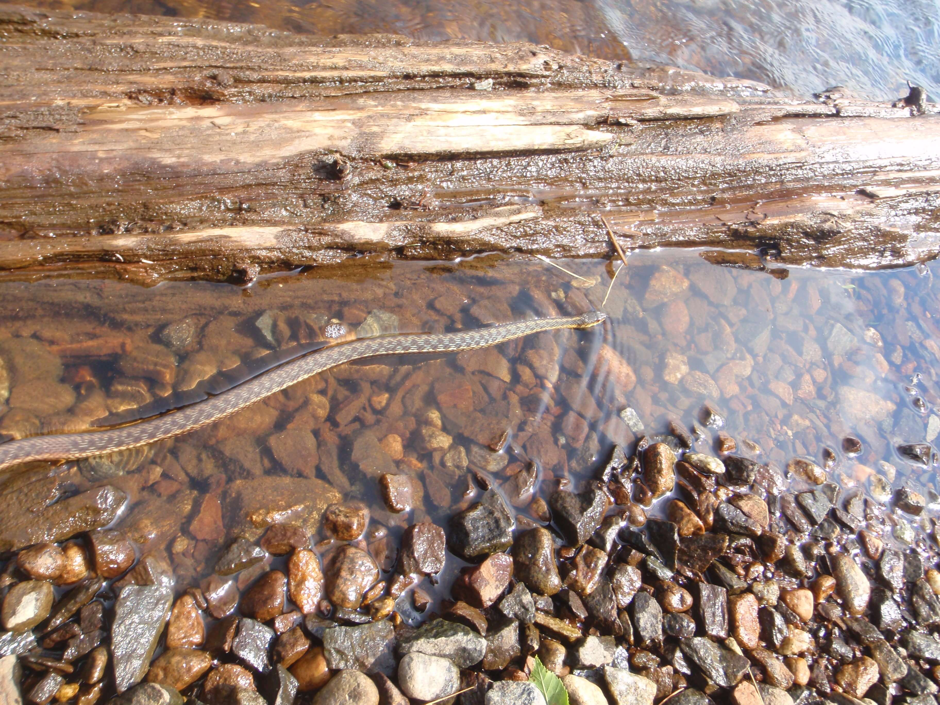
At the portage to Utowana Lake I was greeted by a garter snake out for a dip in the shallow water. It still amazes me that snakes can swim, and as I lifted the Rapidfire to my shoulder I chuckled at the many times my friends or guiding guests had, much to their chagrin, made this discovery for themselves. The remainder of the 0.4-mile carry was critter-free, and I was soon back in my boat, paddling on Utowana Lake past a lean-to on the last small piece of state land before Blue Mountain Lake. If you like trivia, Utowana Lake, Eagle Lake, and Blue Mountain Lake together make up the Eckford Chain of Lakes, named for Henry Eckford, a 19th century boat builder who completed one of the first notable surveys of the surrounding area. Though Eckford primarily built naval gunboats, I still imagined what he would have thought about the modern, ultra-lightweight canoes we paddle today. In addition, the Marion River Carry was recently purchased by New York state from the Open Space Institute for the Adirondack Forest Preserve, ensuring it will remain open to the public for generations. An interesting fact about the carry is that it was home to the shortest standard-gauge railroad line in the country, just 1,300 feet, when it operated from 1900 to 1929.
Castle Rock
The traverse between Utowana and Eagle Lake was uneventful, and once through the Eagle Lake narrows I was greeted by the climactic view of Blue Mountain standing guard over its namesake lake. Complete with a variety of islands, the largest of which are state-owned and have campsites available free of charge for public use, Blue Mountain Lake has many recreational possibilities. Among them is a climb up Castle Rock, which rises modestly from the northern shore of the lake. This peak is unique in that one of the hiking trails begins at the water’s edge, a feature shared by only a few other mountains in the Adirondacks. After a windy trip across the lake, I landed my canoe at the beginning of this trail and set out towards the summit.
Besides the lakeside trail, another unique feature of this peak is a cluster of small caves part way up the trail. I had explored these caves in the winter several years earlier, and found them to have many more mosquitoes hiding in the nooks and crannies during the summer, thus encouraging me not to linger. The summit of Castle Rock resembles a medieval castle rising above the treeline, which not only inspired its name but also allows for fantastic views of the entire lake below. The summit of a beautiful Adirondack mountain is the perfect time for a camera to die, and that day my own memory-capturing device was no exception. Alas, I suppose I’ll just have to go back!
Completing the Trip
The sun was beginning to set as I returned to my canoe. By now the wind had died down, and the paddle across the lake to the takeout beside the public beach was much less challenging. A purple hue had washed over Blue Mountain, and shadows highlighted the rolling topography of its slopes. I arrived back at my car, having completed a bike shuttle at the beginning of the trip, with just enough daylight to go for a quick dip myself. For better or for worse, no snakes joined me this time.
Resources
The Raquette Lake to Blue Mountain Lake trip via Marion River can be found on NFCT Map 1. A short description is also available in the Northern Forest Canoe Trail guidebook. Both items can be purchased in the NFCT’s online store.
Tyler Merriam is an NFCT trail maintainer, who is licensed guide in NY and Maine. He works at Adirondack Lakes and Trails in Saranac Lake.