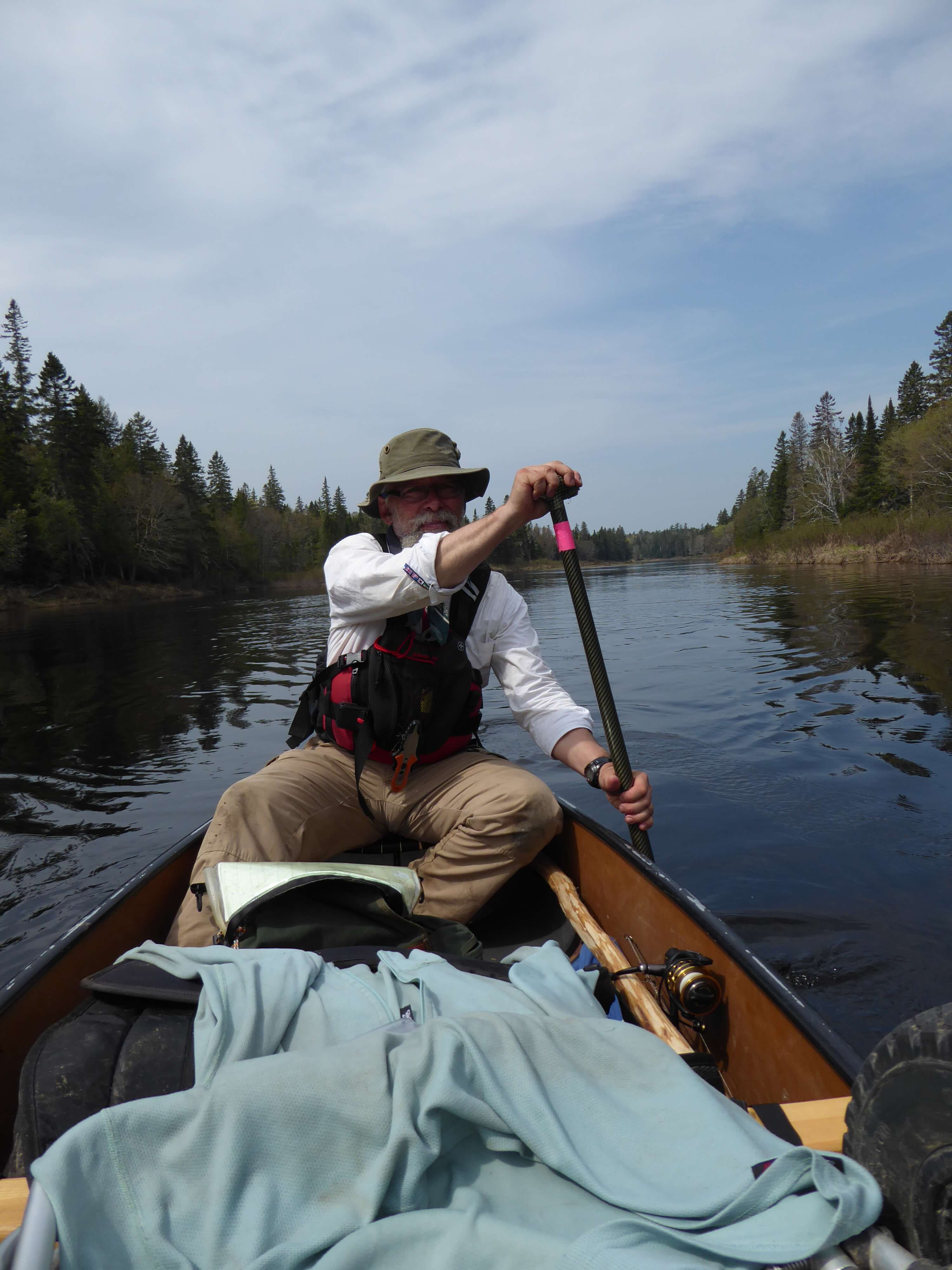
 On a beaver stream somewhere north of Mount Katahdin: It’s nearing dusk as we round a corner and find our route blocked by yet another tangle of blown-down spruce trees. The last mile and a half of travel have taken us over three hours of wading and dragging our canoe through alder tunnels. We are grateful for the dry suits that have made this early season trip possible, as we stand armpit deep in 42 degree water sawing obstructions to create a passage for our vintage Mad River Explorer. We have not seen any sign of human activity for miles: No trash, no canoe-colored marks on rocks, no portage blazes or old cut stumps. There are also no recognizable campsites. Grateful that we are still before black fly season we chose a flattish area of sphagnum moss and clear away enough spruce and fir saplings to pitch our tent for the night. We are already two days behind schedule, and I am beginning to admit that our route is a historical footnote more than a practical means of reaching Fort Kent. But we know that George Coffin and Daniel Rose came this way as they surveyed the Maine border region in 1829. The only modern traveler I know who admits to have followed this route is Ron Canter, a founder and board member emeritus of the NFCT.
Charen and I are avid paddlers. I have section paddled the entire Northern Forest Canoe Trail, and she and I met a few years ago at an NFCT event. We are interested by the history of the canoe trail and its connection to the native water trails that preceded modern recreational paddling. Old Forge has always seemed a logical place for the trail to begin, at the end of the Fulton Chain giving easy access to the web of routes crisscrossing the Adirondacks. I was puzzled, however, by Fort Kent. Why not end the trail in Allagash Village? Or for that matter, why end at Fort Kent, rather than continuing down the St John River to Madawaska or further?
Putting this query to the NFCT staff and board I had received the following reply from Ron Canter:
Fort Kent was chosen because the route first suggested for the trail didn’t go down the Allagash. It went east via Webster Brook, Grand Lake Matagamon, Beaver Brook, and the Aroostook, before turning north up the Little Machias to reach the Fish River and come down that to the St. John at Fort Kent, which was a major junction of ancient canoe routes.
The thought behind it was to not add to traffic on the Allagash, and to link to the Aroostook as well. When real work started on the trail, it was switched to the Allagash as a stopgap. It has worked so well, and with the Allagash no more crowded, that the Allagash quickly became the permanent route.
Madawaska might have worked as well as the terminus, but somehow it never occurred to us to consider it. A town like Fredericton, farther down the St. Johns, would have closed off some of the best options for extending the trail north or northeast into Canada in the future. A route up the Tobique and down the Nepisiguit through New Brunswick would be a particularly good fit for the NFCT.
Exploring A Lost Canoe Route
I acquire the topographic maps covering the route and put in hours peering at aerial photos of the connections between the Penobscot and Aroostook watersheds. David Cook’s book Above the Gravel Bar: The Indian Canoe Routes of Maine reveals a few more details. We set our launch date for mid-May, hoping to take advantage of higher water levels while avoiding black fly season. Our put-in is the Chamberlain Bridge Ranger Station. From here most paddle trips head north on the Allagash Waterway, joining the NFCT at the outflow from Mud Pond. We head south however, following Henry David Thoreau’s route down to the East Branch of the Penobscot River.
The Telos Cut is running high with the spring freshet and we are glad to portage around it to Webster Lake. Webster Stream is up in the streambank alders. Although there is no official gauge for this river, a ranger later estimates that it was flowing at 800 to 1,000 cfs (cubic feet per second). The AMC Maine River Guide rates Webster Stream at above 600 cfs as “difficult and dangerous.” The high water requires that we land and begin each of the carries far above the usual, unmarked take-outs, forcing us to bushwhack long distances with our canoe and gear. While waiting for me to catch up, Charen encounters a male Ruffed Grouse putting on an enchanting courtship display for a nearby hen.
On Grand Lake Matagamon, we leave the familiar East Branch route (now part of the Thoreau – Wabanaki Trail) and head up a winding channel through wetlands called Hay Brook Logan. We have encountered several place names with ‘Logan’ and ‘Bogan’ in them on the Penobscot, Allagash, and St John Rivers, and they appear to derive from a native Maliseet word that Thoreau transcribed as pokelogan or spokelogan. In northern Maine these places contain a backwater, wetland, or shoreline inlet, and bogan and logan were particularly used by loggers to describe places out of the current where logs might get caught during a river drive.
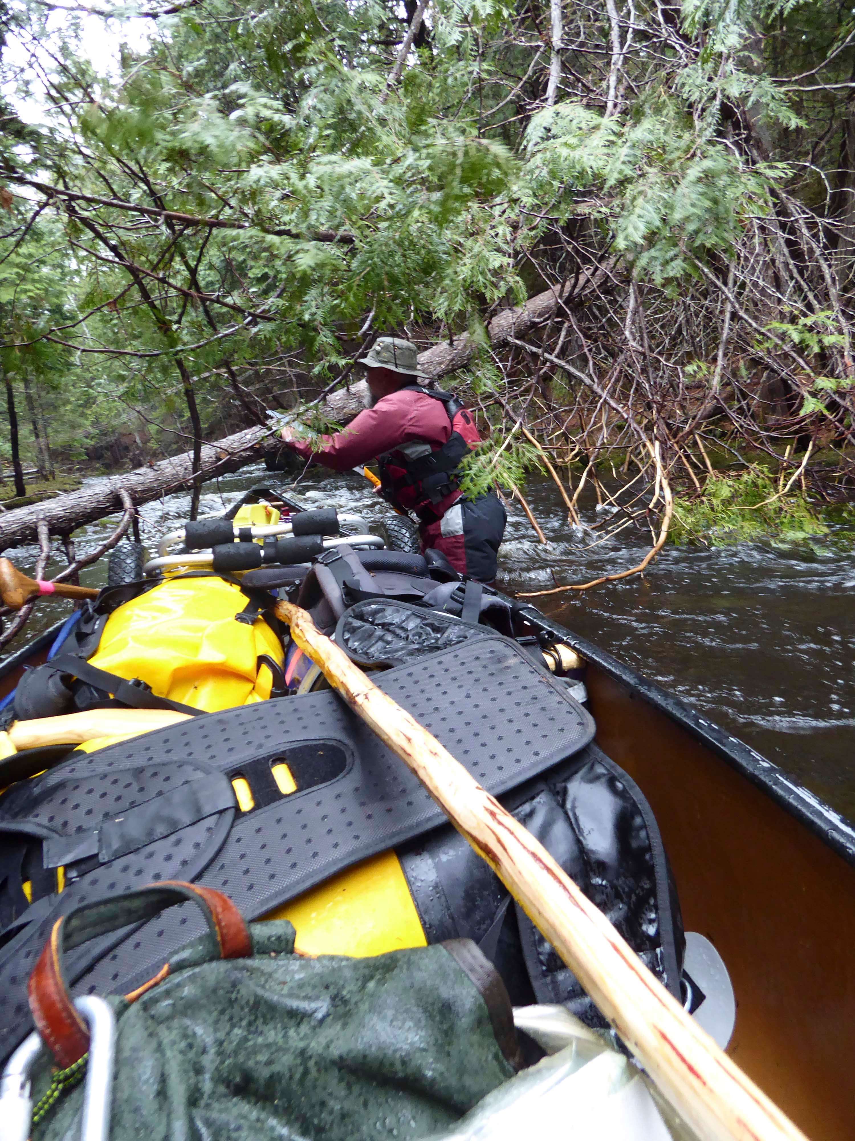
Reaching the point where a trout stream tumbles into the logan we stop for a snack and cut and peel a dead white cedar sapling for a canoe pole. Working our way up the stream we come to the bottom of a set of ledges and a small waterfall. Scouting reveals no trace of a carry. Carrying our paddle and day packs we scout a likely route on the inside of the bend to the top of the falls. Returning to the canoe we use our axe and saw to open up enough of a carry trail to make carrying the canoe practical, and we mark the trail with axe blazes visible from the water at both ends.
Normally we are hardcore Leave No Trace travelers in the back country. I have mixed feelings about the traces we are leaving on this landscape. We are somewhere near the unmarked boundary between Baxter State Park and the privately owned lands administered by Maine North Woods, Inc. Much of what we treasure about remote canoe trips is the chance to experience places that have not been loved to death. Campsites my grandfather enjoyed as a young man paddling in the Adirondacks have been closed by the Department of Environmental Conservation to allow shorelines to recover from a hundred years of camping, which resulted in eroded shorelines and denuded campsites. Yet this stream and other parts of this route have become almost impassible in that same hundred years, as the canoe disappeared as a daily tool of people living and working in the north woods.
An hour later our stream divides. We know from the map that we can reach a logging road nearby. Although it would be impassible in a motor vehicle we do fine wheeling our canoe up the road, heading (uphill) towards the divide between the Penobscot and Aroostook watersheds. Reaching a larger road we happily accept a ride from a local couple out picking fiddlehead ferns. I sit on the tailgate of their vehicle holding the grab loop on the bow of our canoe, and it happily wheels along behind us as we drive along. (Please, don’t try this at home!)
Our ride drops us off near a muddy trail leading down to Little Beaver Pond. From here, Beaver Brook drains to Millimagassett Lake and the Aroostook. The map shows 4.5 miles of low gradient stream. GoogleEarth shows boreal forest and beaver habitat. Neither reveals the masses of downed trees, driftwood, and alder thickets tangling our way. According to my notes, we needed 7 hours to travel that 4.5 miles downstream. On another note, the trout were large and uneducated.
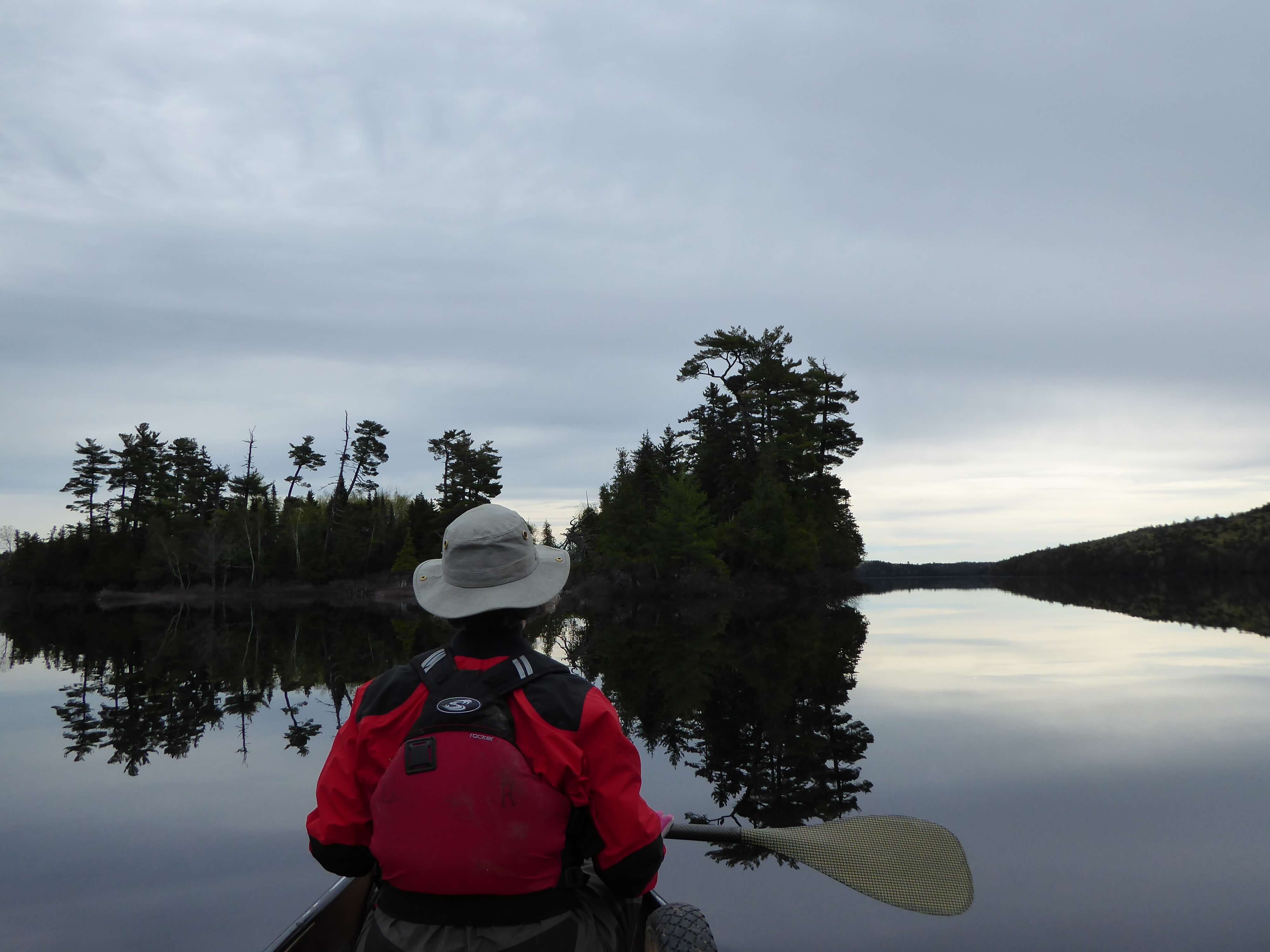
On Millimagassett Lake we encounter a group of several canoes under the tutelage of Tim Smith, Maine Guide and dean of the Jack Mountain Bushcraft School. His students are learning the Maine Guide canoe stroke using tall wooden paddles they have carved themselves. Tim is a friend of friends, although we have never met before. He seems surprised to see a strange canoe on these waters, and tells me that in more than 20 years of guiding on Millimagassett he has never seen another canoe tripper here, and has definitely never seen anyone emerge from Beaver Brook. He is curious about the details of our route, and in return gives us some tips about campsites along the Aroostook River.
The upper Aroostook alternates swiftwater sections lined with white cedar and spruce with stillwater stretches and wetlands. It has something of the feel of the upper St John, and includes occasional rustic hunting and fishing cabins along the way. North Maine Woods, Inc. once maintained campsites for paddlers on this river, but for the most part these appeared abandoned and unusable, other than one or two that the Jack Mountain Bushcraft crew use and maintain. We manage to find one of these, and are serenaded by bitterns, a chorus of American toads, and a coyote as we cook our dinner. Hepatica is blooming in the woods, and I swat the first few blackflies while I try to land a trout to add to our meal.
This is our final night on the water. On our last day we reach the village of Masardis. Our truck is many miles away in Fort Kent, reachable by canoe via Portage Lake and the Fish River, but we are two days behind schedule, the black flies are coming out in force, and we are happy to find a ride with someone from a local guide service to pick up our vehicle.
Although the Hay Brook Logan – Beaver Brook route can be travelled, I am sure it will never replace the Allagash Wilderness Waterway. It is dangerous in high water and might be nearly impassable in a dry summer. The portages are long and arduous. It demands a far higher level of paddling skill and route finding. At the same time all this may have been part of its appeal to us. New England is full of these almost lost canoe routes, potential side trails to the NFCT, connections across the divides between the great rivers of the North Country. Many are still barely documented, hinted at in a few books and in the notes of older paddlers. In 1849 Thoreau was writing about the country around Katahdin when he said: “We have advanced by leaps and bounds to the Pacific, and left many a lesser Oregon and California unexplored behind us.” I am glad we have well marked routes such as the NFCT and the Thoreau-Wabanaki Trail, but I am also grateful for the ‘lesser Oregons’ and forgotten logans those trails pass by.
(Note: Russ Ford and Charen Fegard completed this trip in May 2017)
Bibliography
Cook, David S. Above the Gravel Bar: The Indian Canoe Routes of Maine. Milo Printing Company. Milo, Maine. 1985.
AMC River Guide: Maine. 3rd Edition. Appalachian Mountain Club. Boston, MA. 2002.
Donald B. Sands. Two Maliseet Derivatives in Current Maine and New Brunswick Forestland Speech: Logan and Bogan. Names, A Journal of Onomastics. Vol 32, No. 4. December 1984.
Thoreau, Henry David. The Allagash and East Branch. 1864.
Thoreau, Henry David. Ktaadin. 1848.