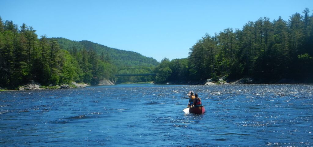
This beautiful, 12.5 mile stretch of the Androscoggin River straddles the Maine-New Hampshire border, offering views of Maine’s rolling mountains, as well as glimpses of the mighty Presidential Range that rises in New Hampshire. As this river drops through valleys, the current remains strong for the majority of the time, making what might seem like a hefty 12.5 miles a pleasant half-day paddle. If you want a shorter paddle, however, you can either begin or take out at Gilead Bridge, an access halfway between Shelburne Bridge and Newt’s Landing. Many side channels offer nooks to explore; however, depending on the water level, many of these side channels will be too low to paddle through. Enveloped by trees and mountains, and gliding on calm, quick water, you can expect a pleasant, scenic paddle as you paddle between these points.
Trip Details
- Trip Duration: 1 to 1 days
- Miles: 12.5
- Put In: On Route 2 in New Hampshire, turn onto Meadow Road going across a river. After crossing the bridge, there is a gravel turnoff on the left with space to park. From there, walk boats down to the river under the bridge where there are rocks that can be used to launch.
- Take Out: Take Route 2 to West Bethel and then turn onto Ferry Road. From there bear right until reaching the end of the road. Take a left down a gravel road to the launch. The access points features stairs going down the the river as well as a wooden ramp.
-
Services:
- Androscoggin River: Shelburne to Newt’s Landing
- Trail Features