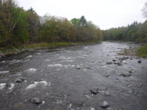
 The Carrabasset is a mountain river with its headwaters on the flank of Maine’s Sugarloaf Mountain. While its headwaters reaches are rugged and hard to catch, a seven mile stretch below Kingfield runs frequently in May and is great option for intermediate paddlers. Look for 500-1500 CFS on the USGS gauge in North Anson.
The river is relatively calm at first, with a few Class I rapids. About halfway through the rapids become more frequent and are typically Class II, but can become Class III at high levels. This trip ends at the New Portland Wire Bridge, listed on the National Register of Historic Places.
Trip Details
- Miles: 7
- Trip Portages: None
- Put In: Kingfield Dam: Off of Route 16, in the center of Kingfield, there is a small business complex. In the parking lot behind the buildings is an informal access to the Carrabassett River just downstream of the dam.
- Take Out: New Portland Wire Bridge: Heading south on Route 27 from Kingfield, turn left onto Route 146. Then take a left onto Wire Bridge Road. Drive across the bridge where there is a field next to the river and a sandy path down to the water that can be used for hand-carry access.
-
Services:
- Carrabassett River
- Trail Features