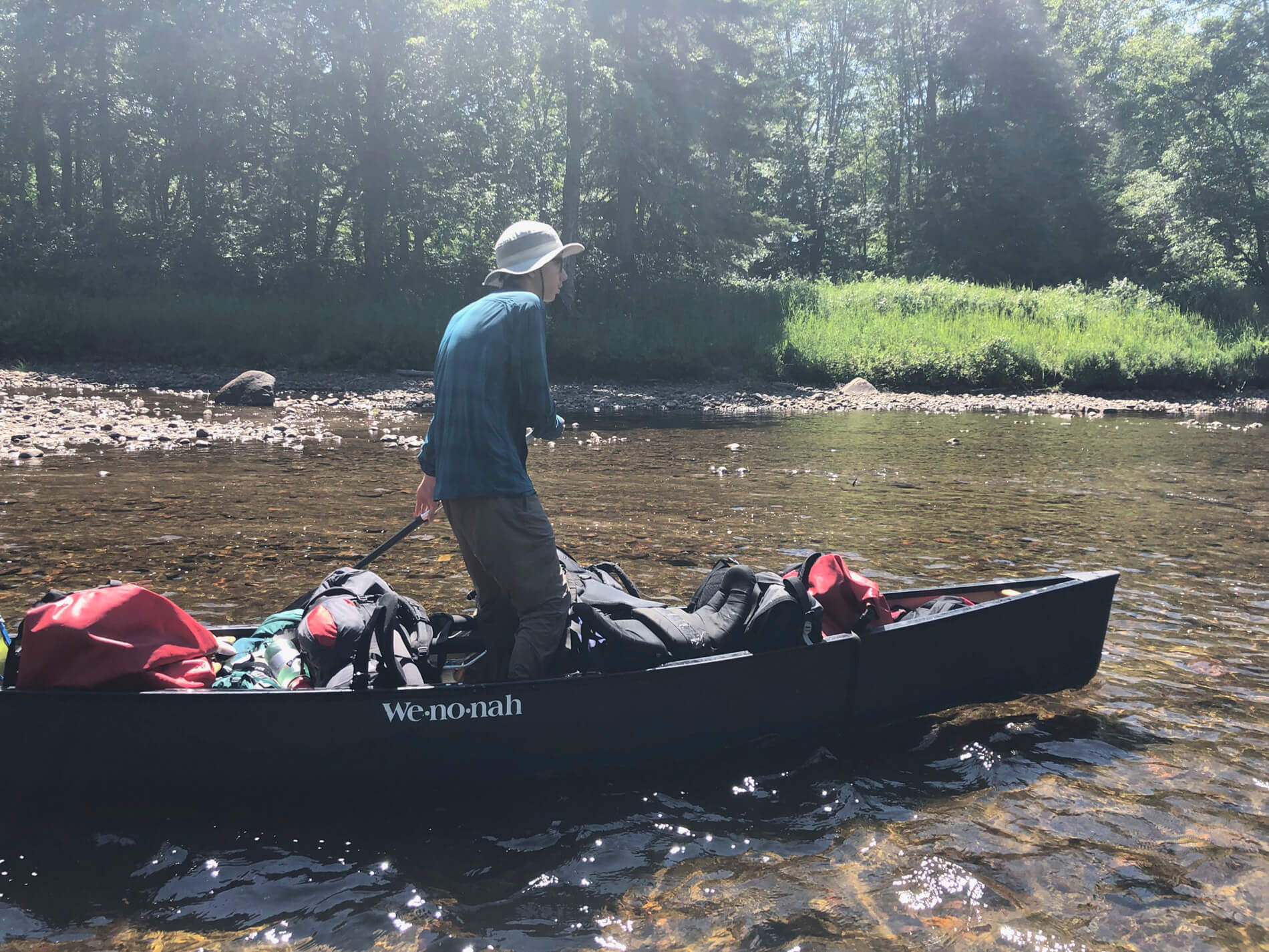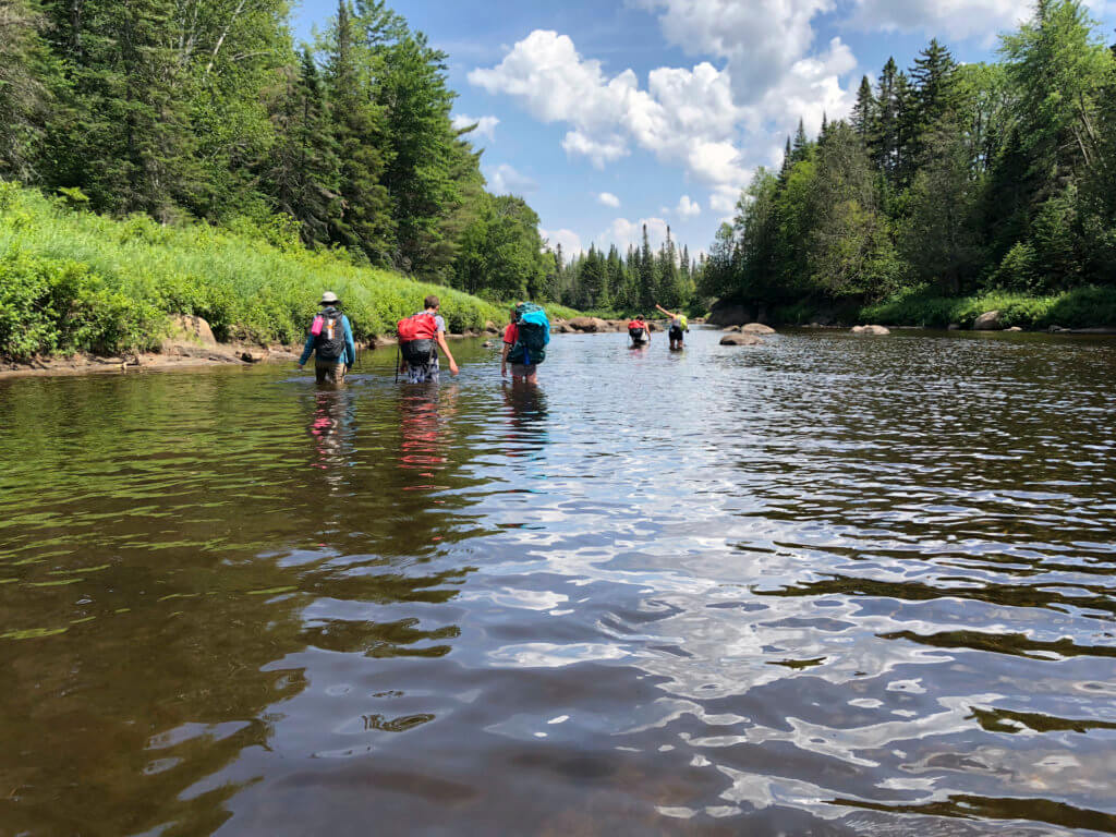
There was no easy way forward. Tangles of overgrown beeches, witch hobble, and fallen spruce loomed in front of us. Miles of cobbled riverbed, at times too shallow to paddle, at times too deep to wade with a full pack, lay behind.
It was well past four o’clock on day two of the Northern Forest Canoe Explorers five-day trek on the Raquette River in July, and we had left the Raquette behind hours ago for the Cold River. With almost all of the paddlers having paddled this route before, from the hamlet of Long Lake to the Crusher on the Raquette River in Tupper Lake, we had made a challenging side trip to follow the Cold River east to Shattuck’s Clearing, the site of an old ranger cabin long since gone and several logging encampments before that.
Most denizens of the iconic Raquette Falls trip travel its 30 miles of water in comfortable style, with the 1.25 mile portage around the rapids and the multiple trips laden with boats and gear being the one big “apex of effort” on this well-traveled journey. This route allows for a few day’s taste of undeveloped wilderness which is mostly accomplished in canoes. The trip is great for mixed abilities and a prime glimpse of what the heart of the Adirondacks has to offer.
But I had done my homework, and I had been there….the point where the Northville Placid Trail intersects the Cold River would be a significant point to explore, with lots of interesting history, the seldom seen grandeur of the Cold River that Noah John Rondeau had lived in, and best of all an achievable challenge to our campers who would have to reconfigure their gear, work together and make decisions as obstacles arose.
 As often happens, this kind of adventure seems different when discussed, as we did on the sunny swimming rock of Kelly Point, where we had decided on day one as a group to aim for this goal. Now, with tree branches slapping us in the face, frequent forays to look for the best route around a deadfall or find a trail marker, with our faces grim with determination as the route got harder and the day later, everything seemed more immediate, more serious. More real.
We had repacked our gear at Caulkins Creek Lean-to, bringing only what we needed for one evening further up the river. Most of the dry bags and food barrels had been stashed for our return. We had strategically spread everything for our overnight across the assortment of day packs that we had, with many an older explorer taking on a little extra to make loads more manageable for others. The ages of our group ranged between 10 and 15.
And one obstacle had yielded to another. The herd path I remembered from my DEC days along the south shore of the Cold River had completely grown in. Using the river as path had proved pretty difficult with our packs because shallow would suddenly give way to waist or shoulder deep water. When we finally did make it to Pine Point, where there was an official trail going eastward 3 miles to Shattucks Clearing, we discovered it had been years since it had been cut out. So naturally group morale continued to decline as everything seemed wilder and harder every step of the way. I remember taking our oldest member, our “guide in training” aside to remind her how important it is to keep our repartee “positive” when the going got tough for everyone, to help keep everyone’s spirits up. It was as much for my sake as for everyone’s…it was a tough day.
When we stumbled into Shattucks Clearing (which is by now merely a wide part of the trail with several signs marking distances to Long Lake, Placid, Duck Hole) at nearly six, there was much relief. Packs were shed, oranges and snacks were shared and our final destination, Cold River lean- tos #3 and #4, was only two suspension bridges and less then a mile of clean trail away.
An hour later, smiles had reappeared, our takeover of the remote and beautiful Cold River lean-tos was complete, and everyone lounged, swam and drank it in. After dinner, we reflected around the fire on what we had done to get there and the worth of it.
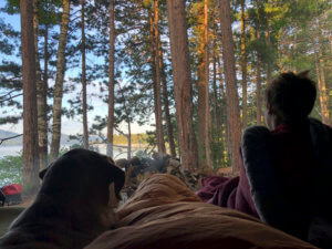
 Waking up the following day with the eastern light shining directly into our lean-to (the so called “Honeymoon lean-to” which looks directly up the cold river), I watched one of the younger and quieter member of our team lay in his sleeping bag, head propped up on his hands, looking out at the river. He did this for nearly 20 minutes, saying nothing; and as it was early, everyone else continued to sleep in. But his gaze seemed to mark an appreciation of the things we had done and seen that were maybe beyond words.
The evening before, mid-bushwack, I had been turning over possible scenarios in my mind to make an easier return for us, not really able to see any in the midst of our difficult trek. But this morning, with a hot breakfast and perhaps the best night’s rest I had enjoyed this year, we all discussed the return back and already it seemed easier. Or at least, more manageable.
Some of the explorers had suggested that rather than the rugged trail we make more use of the river on our return. Although this also had presented some difficulties on the way in, we got out to the river pretty quickly on the way back and found it preferable and beautiful.
Upon arrival at Pine Point (amidst whoops of joy) I left everyone with my wife and fellow guide Amy for a leisurely lunch on the rocks. I returned 40 minutes later with a single canoe which we then used to float all of our gear in, allowing the remaining mile or two of our trek to become an easy swim/wade.
 Upon reflection, this was one of my most memorable days ever on this stretch of river, with the gorgeous sun reflecting off of the pebbly bottom, the relief of no weight on our backs and the known in front of us bringing with it a lightness of spirit and lots of splashing and laughing. I took turns with one of the explorers paddling the gear stand-up style like a gondola, which sealed his trail name for him—the Galloping Gondolier.
By popular consensus, one of the trail games we played this day was to develop our trail names. The two immutable rules: your name must be nominated by someone else and everyone (including the recipient) in the group had to unanimously agree upon it for it to be “official.”
Upon our regaining our boats and gear around 4 o’clock, I put the decision to the group that we could either camp there at Caulkins Lean-to, resting up for an early start the following day, or that we could press on that afternoon to the Raquette Falls Carry, which would put us there at the very end of the day.
Our party, each speaking one at a time about what they thought we should do and why, seemed to be split down the middle between staying or pressing on. Encouraging everyone to break down the merits and energy level of everyone in making this decision, the group eventually decided to push on, with the caveat that those who most wanted to press on would make two trips for the carry on that evening. The others would make one trip and work with Amy to get camp and dinner ready. I was proud to find our Guide in Training (trail name—GIT DIRT) was integral in moderating this decision; apparently she really had been listening when we talked about the role of leadership in these situations.
It was day 3 of the trip, and everyone was working well together, making good team decisions and working together to push ourselves forward. Although the Cold River foray was unquestionably the most difficult part of our journey that week, the bonding and accomplishment of that time set the tone for the rest of that trip, getting us to and over the carry that very night.
I went to sleep that third night wondering how many people in history have woken up at Shattucks Clearing looking up the Cold river and finished that same day on the beach below Raquette Falls, on the other side of the portage, watching the water roll over the rocks.
(Matt Burnett operates Matt Burnett Guiding in the northern Adirondacks. This trip was outfitted and organized by Raquette River Outfitters in Tupper Lake, New York.)